Surveyor-General diagram, 1014/1913, March 1913
Surveyor-General diagram, March 1913
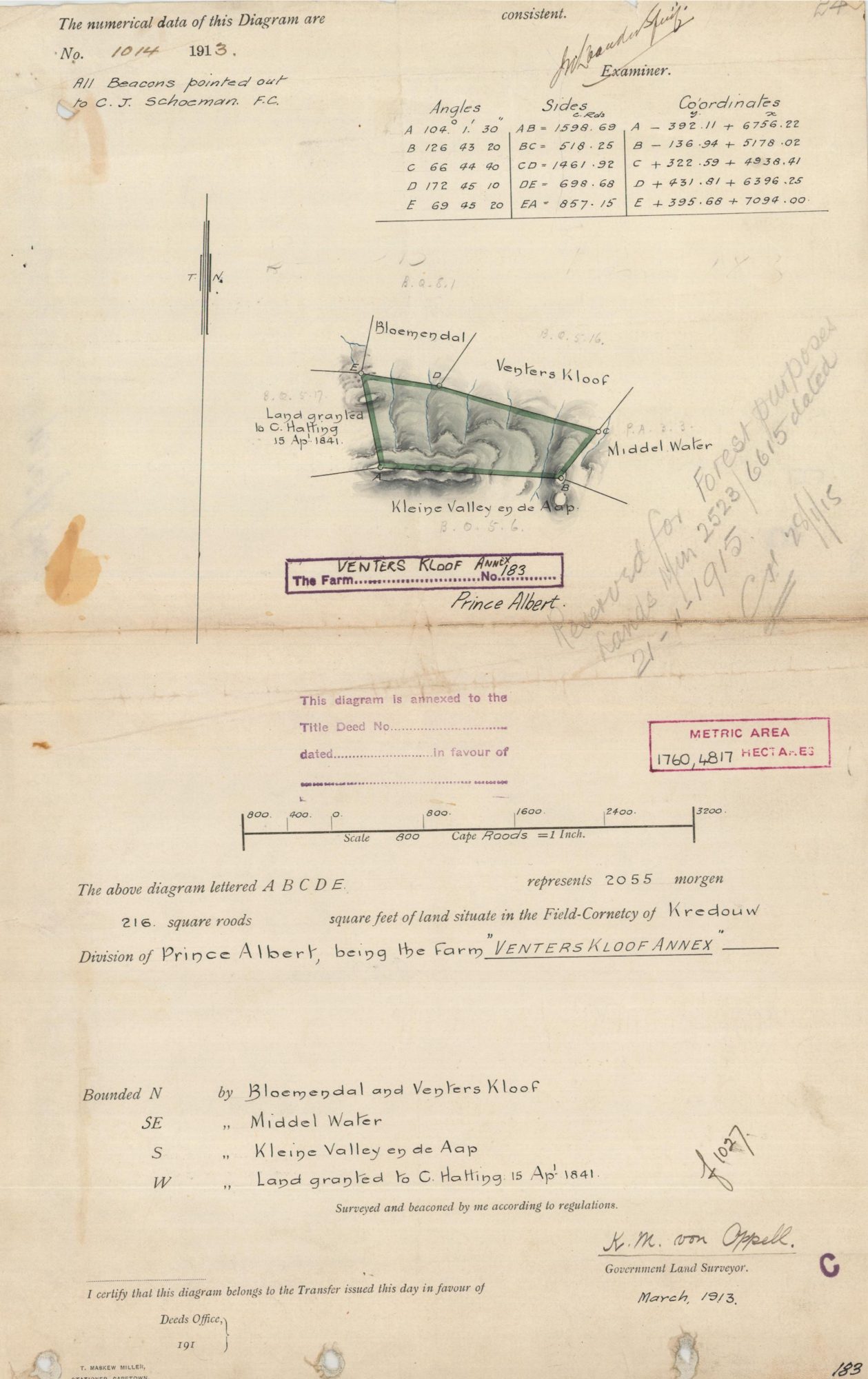
11659886.PDF.The record
- Type
- Surveyor-General diagram
- Diagram number
- 1014/1913
- Surveyed
- March 1913
- Surveyor
- K.M. von Oppell
- Archive filename
- 11659886.PDF
Citation
- Title
- SG diagram 1014/1913, Venters Kloof Annex No. 183, Prince Albert
- Repository
- Surveyor-General, Cape Town (SGCTN)
- Reference
- dgm 1014/1913
- Type
- SG diagram
- Retrieved
- 2026-07-31
The ground it is about
Venters Kloof Annex No. 183 183
Research notes
[31 Jul 2026 inbox] Names C. HattingM as an 1841 grantee and shows 'Kleine Valley en de Aap' as one granted unit.
[17 Sep 2026] Re-read at full size when Boundaries: N Bloemendal and Venters Kloof (pencil 'B.Q.5.16'), SE Middel Water (pencil 'P.A.3.3'), S 'Kleine Valley en de Aap' (pencil 'B.Q.5.6'), W 'Land granted to C. HattingM 15 Ap. 1841' (pencil 'B.Q.5.17'). Field cornetcy of KREDOUW; beacons pointed out to C.J. SCHOEMAN F.C. Pencilled: reserved for forest purposes, Lands Min. 2523/6615, 21-1-1915. THE SG's esio index files a second page under 1014/1913 (10701787.PDF) that does not belong to this farm: a red-line beacon report of January 1909 for the general plan of Twee Rivieren and Adjoining Twee Rivieren, Lower Long Kloof, division of Uniondale, which shares the 1913 general-plan number run 1000-1030. Not filed here.
The research behind this page, kept separate from it: dated working notes, open questions, and what is not yet settled.