Surveyor-General diagram, 285/1939, August 1938
Surveyor-General diagram, August 1938
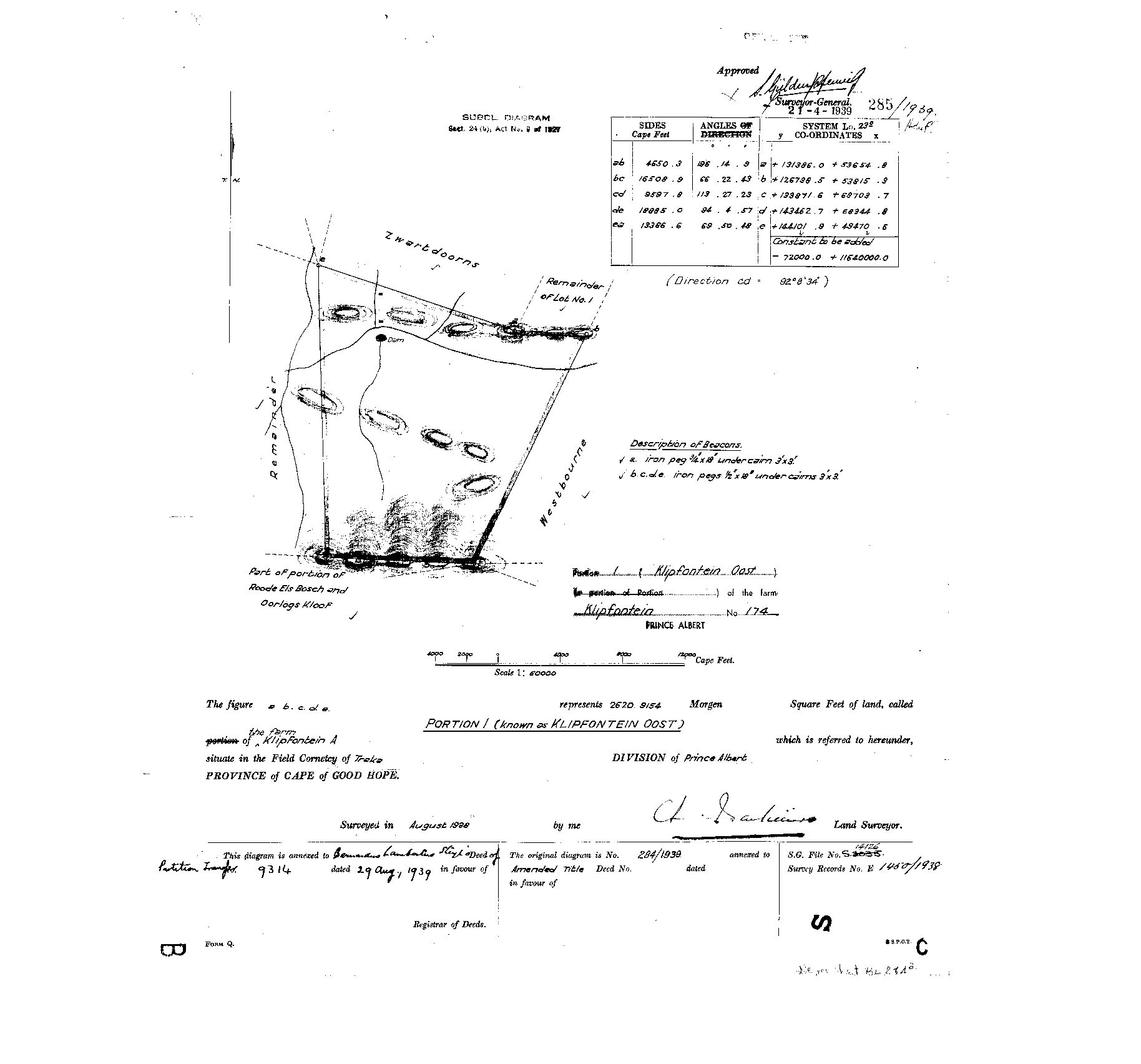
10513531.jpg.The record
- Type
- Surveyor-General diagram
- Diagram number
- 285/1939
- Surveyed
- August 1938
- Titled
- 29 August 1939
- Deed
- 9314
- Archive filename
- 10513531.jpg
Citation
- Title
- Klipfontein Oost, Portion 1 of Klipfontein A No.174, diagram (1939)
- Repository
- Surveyor-General
- Reference
- SG Dgm 285/1939; S.G. File S.14126; Survey Records E.1450/1938
- Type
- SG diagram
- Retrieved
- 2026-07-31
The ground it is about
Klipfontein Oost (Klipfontein A No. 174 Ptn 1)
Research notes
"The figure a b c d e represents 2620.9154 Morgen of land, called PORTION 1 (known as KLIPFONTEIN OOST), portion of the farm Klipfontein A, situate in the Field Cornetcy of Traka, DIVISION of Prince Albert." Subdivisional diagram under Sect. 24(b), Act No. 9 of 1927; surveyed August 1938; approved by the Surveyor-General 21 Apr 1939. "This diagram is annexed to Partition Transfer Deed No. 9314 dated 29 Aug 1939 in favour of Bernardus Lambertus SteylM. The original diagram is No. 284/1939." S.G. File S.14126; Survey Records E.1450/1938; System Lo.23. Beacons a-e iron pegs under 3'x3' cairns. Drawn neighbours: Zwartdoorns, Remainder of Lot No 1, Westbourne, the Remainder, and part of portion of Roode Els Bosch and Oorlogs Kloof. [31 Jul 2026 inbox]
[3 Aug 2026] publish_ok=yes. This is an OLD FARM DIAGRAM held back only because a TRANSFER ENDORSEMENT on its face crosses the 1936 scan cut-off - the survey itself is from the 1920s or 1930s. The names on it are the surveyor, the neighbouring farms and a transferee of the 1930s or 1940, all long dead and most of them already published as person records here. Reviewed individually, not opened as a category.
The research behind this page, kept separate from it: dated working notes, open questions, and what is not yet settled.