Diagram verso, 1177/1940 (verso)
Diagram verso
10JS4801.TIF.The record
- Type
- Diagram verso
- Diagram number
- 1177/1940 (verso)
- Archive filename
- 10JS4801.TIF
Citation
- Title
- Oorlogs Kloof No.175 diagram - verso deductions
- Repository
- Surveyor-General
- Reference
- SG Dgm 1177/1940 (verso)
- Type
- SG diagram
The ground it is about
Oorlogs Kloof No. 175 (1940 consolidation) 175
Research notes
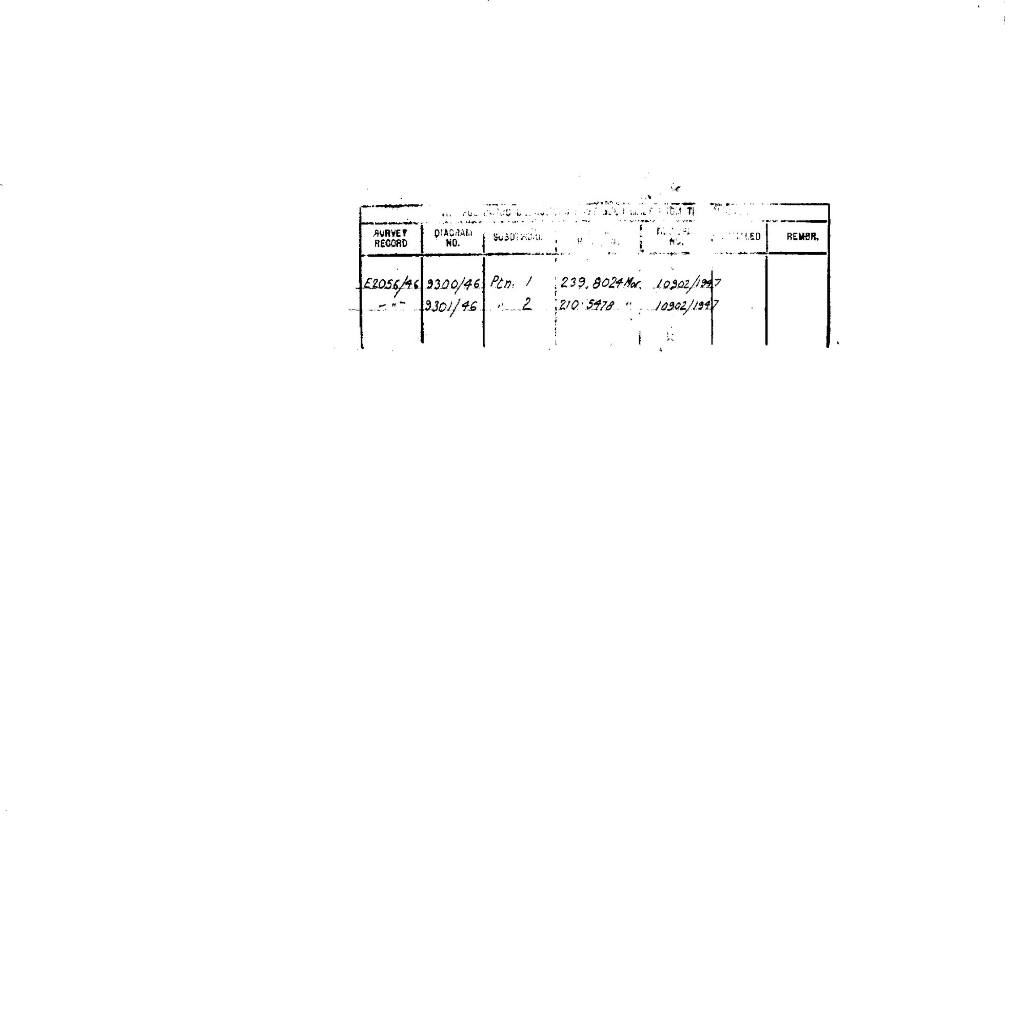
Deductions from the 1940 consolidation diagram: survey record E2056/46, dgm 9300/46, Ptn 1, 239.8024 morgen, [deed] 10902/1947; dgm 9301/46, Ptn 2, 210.5478 morgen, 10902/1947. Matches the modern cadastre's 1/175 and 2/175.
[3 Aug 2026] publish_ok=yes. This is an OLD FARM DIAGRAM held back only because a TRANSFER ENDORSEMENT on its face crosses the 1936 scan cut-off - the survey itself is from the 1920s or 1930s. The names on it are the surveyor, the neighbouring farms and a transferee of the 1930s or 1940, all long dead and most of them already published as person records here. Reviewed individually, not opened as a category.
The research behind this page, kept separate from it: dated working notes, open questions, and what is not yet settled.