Surveyor-General diagram, 4275/1921, December 1921
Surveyor-General diagram, December 1921
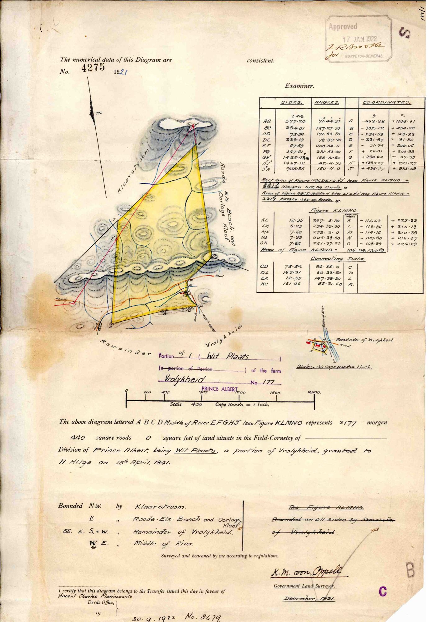
10753144.PDF.The record
- Type
- Surveyor-General diagram
- Diagram number
- 4275/1921
- Surveyed
- December 1921
- Titled
- 30 September 1922
- Deed
- 8479
- Surveyor
- K.M. von Oppell
- Archive filename
- 10753144.PDF
Citation
- Title
- Vrolykheid Portion 1 "Wit Plaats" diagram (coloured)
- Repository
- Surveyor-General
- Reference
- SG Dgm 4275/1921
- Type
- SG diagram
The ground it is about
Wit Plaats (Vrolikheid No. 177 Ptn 1)
Research notes
Hand-coloured. "Wit Plaats, a portion of Vrolykheid, granted to N. HitgeM on 15th April, 1841." 2177 mg 440 sq rds less Figure KLMNO (106 sq rds). Bounded NW Klaarstroom, E Roode Els Bosch and Oorlogs Kloof, SE/S/W Remainder of Vrolykheid, NE Middle of River. Transfer to Vincent Charles MarincowitzL. [CORRECTED 29 Jul 2026] original_filename was recorded as the descriptive label "vrolykheid 1922 hitge.pdf"; the true TRIMCO archive scan name, 10753144.PDF, surfaced via the inbox, sitting immediately before DOC-0030's own 10753145.PDF in the same archive sequence - strong evidence this is the real original filename, not a rename of the source.
The research behind this page, kept separate from it: dated working notes, open questions, and what is not yet settled.