Surveyor-General diagram, 432/1834, 1834
Surveyor-General diagram, 1834
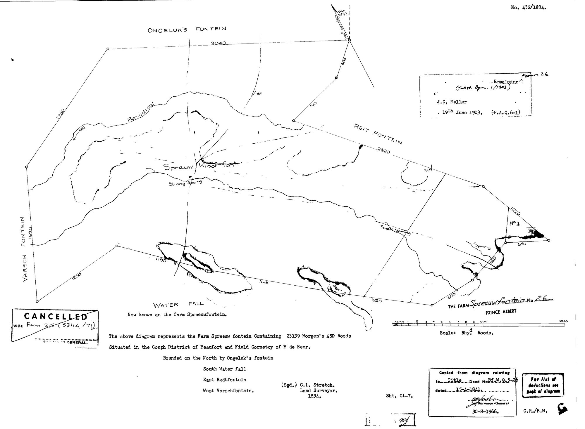
SCAN199.TIF.The record
- Type
- Surveyor-General diagram
- Diagram number
- 432/1834
- Surveyed
- 1834
- Titled
- 15 April 1841
- Deed
- Bf.W.Q.5-26
- Surveyor
- C.L. Stretch
- Archive filename
- SCAN199.TIF
Citation
- Title
- Spreeuwfontein No.26 original grant diagram (1834)
- Repository
- Surveyor-General / Deeds e-portal
- Reference
- SG Dgm 432/1834
- Type
- SG diagram
The ground it is about
Spreeuw Fontein & Toornits Kraal (Spreeufontein No. 26) 26
Research notes
ORIGINAL grant diagram. 23139 morgen 450 roods, Gouph District of Beaufort, Field Cornetcy of M de Beer. Bounded N Ongeluk's fontein, S Water fall, E Reitfontein, W Varschfontein. Later box: Remainder (Subst. Dgm 1/1903) J.C. MullerM 19 June 1903 (P.A.Q.6-1). CANCELLED vide Farm 215.
The research behind this page, kept separate from it: dated working notes, open questions, and what is not yet settled.