Wilger Fontein Nr. 59
59 op die kadaster · op rekord 1872–1921 · wys op die kaart
- Plaasnommer
- Nr. 59
- Op die kadaster
- 59, heel plaasgeregistreer as WILGER FONTEIN
- Distrik
- Prince Albert
- Grootte, soos die kaart dit stel
- [?8]827 morgen 450 sq. roods
- Moderne opgemete oppervlakte
- 7572.8 ha
Die historiese grootte en die moderne opgemete oppervlakte is twee aparte metings en word hier nie aangebied asof hulle mekaar bevestig nie. Die eerste is wat 'n landmeter op 'n kaart geskryf het, gewoonlik in morg. Die tweede is wat die moderne kadaster teken.
Waarom hierdie plaas hier is
Frans Stephanus Botma (1881-1921) het hier gewoon. Verbind aan die Oosthuizen, Marincowitz of Van der Merwe-lyne DEUR HUWELIK, nie deur bloed nie, 2 treë op die kortste pad. 88 km van Klaarstroom.
- Frans Stephanus Botma (1881-1921)
- kind van Frans Stephanus Botma (1860-1936)
- getroud met Magdalena Maria van Tonder, born Oosthuizen
Elke tree is 'n aangetekende afkoms of huwelik in hierdie model, en die kortste een wat die rekord ondersteun; volg die name om dit na te gaan.
- storie 'n Geskrewe geskiedenis speel op hierdie grond af The Botmas of Spreeufontein
- perseel Grond uit hierdie plaas gesny: Deelfontein (Wilger Fontein Nr. 59 Gdlt 1)
- perseel Grond uit hierdie plaas gesny: Maraisdal (Wilger Fontein Nr. 59 Gdlt 2)
- grens Deel 'n grens met Scruif Paal Nr. 2 Scruif Paal Nr. 2
- …en nog 2, volledig gelys verder af op hierdie bladsy.
Stories
- set here
The Botmas of Spreeufontein
Four generations of one family on the ground the district called Gatsplaas. A Botma laid out a village there during the 1891 gold rush; his grandfather held the farm when the first gold was found; and a son of the house married four times and buried three wives before he was twenty-six. Two le Grange women married two brothers, and Botes and Niehaus run through the whole of it.
Wat die rekord hou, in volgorde
-
1872
document
SG diagram 581/1873
P.A.Q.2-11
- 1872 document SG diagram verso 581/1873 (verso)
-
17 Mei 1875
ownership
Nicolaas Francois Marais, Charl Johannes Antone Marais
quitrent · grant · confidence high
- 1906 boundary change subdivision: becomes Deelfontein (Wilger Fontein Nr. 59 Gdlt 1)
- 1911 boundary change subdivision: becomes Maraisdal (Wilger Fontein Nr. 59 Gdlt 2)
-
9 Desember 1921
lived here
Frans Stephanus Botma (1881-1921) (omstreeks 1881-05–9 Desember 1921)
death notice · to 1921-12-09
Grond uit hierdie plaas gesny
- Deelfontein (Wilger Fontein Nr. 59 Gdlt 1) 3260.5 ha
- Maraisdal (Wilger Fontein Nr. 59 Gdlt 2) 886.1 ha
Begrens deur, soos die kaart hulle noem
- NE Blaauw Draay
- E Kruid Fontein
- S Riet Fontein
- W Jacobs Kraal
- SW Scruif Paal
Op die afdelingskaart van 1915
Soos die Landmeter-generaal hierdie plaas in 1915 gedruk het: die geregistreerde titelhouer, die datum waarop die titel uitgereik is en die erfpagverwysing, net so van die kaart oorgeskryf. Die hele kaart, plaas vir plaas
| Plaas, soos gedruk | Titelhouer | Titel | Erfpag | Aantekening |
|---|---|---|---|---|
| WILGER FONTEIN | N. F. Marais | 17th May 1878 | P.A.Q. 2.11 · fol. 1437 | The year disagrees with DOC-0352 and OWN-000119, which read this title as 17 May 1875. LEAD-0349. |
Foto's
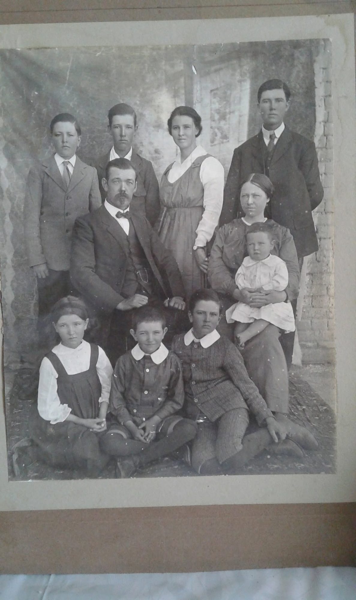
Ook begrens deur, soos die moderne kadaster dit teken
Grond wat aan hierdie plaas raak op die Landmeter-generaal se huidige poligone en wat geen kaart wat hier gehou word, noem nie. Afgelei uit die meetkunde, nie van 'n dokument afgelees nie.
- E Kruitfontein Nr. 33
- E Maraisdal (Wilger Fontein Nr. 59 Gdlt 2)
- SE Rietfontein Nr. 56
- SW Platkops Vlakte Nr. 77
- SW Deelfontein (Wilger Fontein Nr. 59 Gdlt 1)
Dokumente
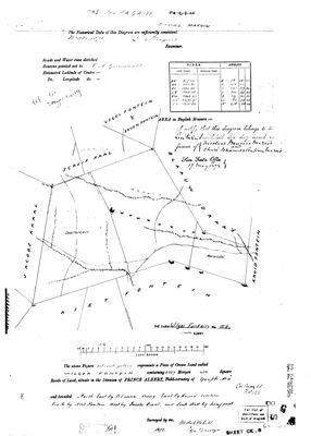 Landmeter-generaal-kaart, 581/1873, 1872
11025620 PA 59.jpg
 Kaart se keersy, 581/1873 (verso), 1872
11025621 PA 59.jpg
Kadaster
Die Landmeter-generaal se kaartindeks vir hierdie perseel
Navorsingsnotas
[SRC-595, SRC-596; 27 Aug 2026] THE FARM'S OWN DIAGRAM ARRIVED, and this row had held nothing but a polygon and a name. Dgm. 581/1873, surveyed 1872, Crown land of [?8]827 morgen 450 sq roods in the Field-cornetcy of GOUPH No. 4, taken into QUITRENT TITLE on 17 MAY 1875 in favour of NICOLAAS FRANCOIS MARAIS and CHARL JOHANNES ANTONE MARAIS jointly (title P.A.Q.2-11). Bounded north east by Blaauw Draay, east by Kruid Fontein (PAR-000315), south by Riet Fontein, west by Jacobs Kraal and south west by Scruif Paal (PAR-000258); Vogel Fontein, Seven Fontein and Welgevreden are labelled beyond. TWO PORTIONS, BOTH ALREADY NAMED ON THE 1872 FACE: DEELFONTEIN, cut in 1906 as Portion 1 (PAR-000325), and MARAISDAL, cut in 1911 as Portion 2 (PAR-000326), leaving a remainder near 4,001 morgen. AND THIS IS THE FARM THE BOTMAS LIVED AND DIED ON: Frans Stephanus BotmaL the younger (PER-001931) died here of fever on 9 December 1921 and was buried here (SRC-594), with his wife reporting it from the same address. The diagram gives the ground its title history; it does NOT yet say how the family came to be on it - no Botma appears anywhere on either sheet, and the 1875 grantees are Marais.
*** THE CADASTRE SETTLES THE ILLEGIBLE DIGIT, 27 Aug 2026. *** The 1873 figures in morgen and the modern polygons in hectares agree to a fraction of a percent, which they could not do if the parent were 2827: parent [?8]827 mg = 7,561 ha against a measured 7,572.8; DEELFONTEIN 3813 mg 530 = 3,266 ha against 3,260.5; MARAISDAL 1013 mg 520 = 868 ha against 886.1. And the remainder predicted from the deduction table, about 4,001 morgen or 3,427 ha, is exactly what is left when the two portions are taken off the measured parent. A surveyor's arithmetic of 1873 and a satellite-era cadastre closing on each other is as good a corroboration as this project gets, and it was reached without ever guessing at the ink.
Werknotas, hier gewys omdat dit 'n private navorsingsbou is.
Die werksnotas op hierdie werf word in Engels gehou en word nie vertaal nie. Hulle verander met elke navorsingsessie, en 'n vertaling sou uit pas raak met die oorspronklike. Alles anders - die stories, die getranskribeerde dokumente en die koppelvlak - is in Afrikaans.
Oop vrae
-
Four farms where the 1915 divisional map and this record give a different title date
prioriteit 3 · LEAD-0349
The 1915 divisional map prints a title date and quitrent number on every farm. On four farms this project already holds, it disagrees with the record: which is right? (1) HAGAS No. 145: the map prints B.W.Q. 5.31 to J.M.J. v. Vuuren and another, dated 24 October 1842; DOC-0131 carries Bf.W.Q.5-31 with a title date of 15 April 1841. (2) WILGER FONTEIN: the map prints 17th May 1878 against P.A.Q. 2.11; DOC-0352 and OWN-000119 read the same title as 17 May 1875. (3) WILGEMOND: the map prints 16 April 1841 against B.W.Q. 5.9; OWN-000075 has 15 April 1841, the grant day. (4) KLIPGAT: the map prints an amended title to the estate of the late L.D.F. v. Zyl as 9.9.191[?1]; OWN-000088 and DOC-0158 have 24 September 1911, P.A.Q. 6-7.
Wat dit sou uitmaak The date written on the quitrent title itself, which both the map and the diagrams copied.
Wat die rekord kortkom
-
The record stops in 1875 and never resumes
second order · B2 trail-ends
Wilger Fontein Nr. 59 was worked as far as 1875-05-17, with Nicolaas Francois MaraisH and Charl Johannes Antone MaraisH the last owner on record. 151 years follow with nothing. Who held it after that, and is it still one farm?
What would settle it The current title deed traced backwards, each transfer names the one before it, or the Surveyor-General's subdivision diagrams, which are what usually explain a farm going quiet.
-
“Riet Fontein” is named as a neighbour 5 times and we hold no parcel for it
second order · B3 unheld-farm
5 separate surveys in this model put Riet Fontein on the boundary of ground we do hold (PAR-000005, PAR-000020, PAR-000025, PAR-000259). It has no parcel of its own here, so nothing is known about who held it or when, while it borders farms at the centre of the project.
What would settle it The Surveyor-General's farm index for the registration division will give it a farm number and a diagram; the cadastre pull in `fetch_cadastre.py` then places it on the map.
Found by breaks.py reading the model against itself, not written by hand,
each one is a shape of missing record, not a fault in the data.
The whole set is on the
questions page.