survey_plan, 2440 OB sheet 2, 1877–1879
survey plan, 1877–1879
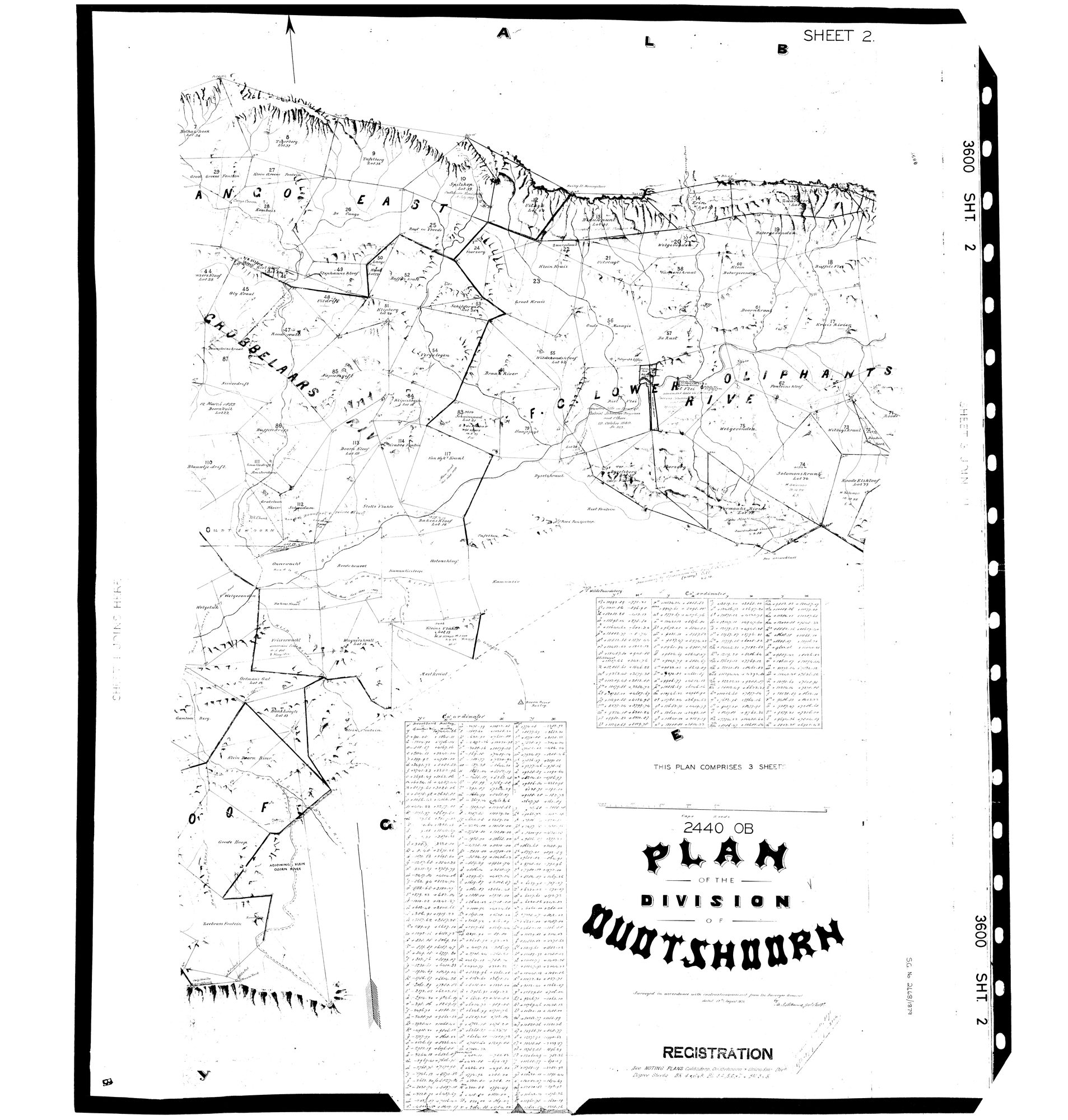
3600_S2.jpg.Die rekord
- Soort
- survey plan
- Kaartnommer
- 2440 OB sheet 2
- Opgemeet
- 1877–1879
- Argieflêernaam
- 3600_S2.jpg
Sitasie
- Titel
- SG 2440 OB - Plan of the Division of Oudtshoorn, three sheets, 1877-1879
- Bewaarplek
- Surveyor-General (via Frans, inbox Original filename 3600_S1.
- Verwysing
- SG 2440 OB, sheets 1, 2 and 3, complete. Two survey references on the sheet: SG 2334/1877 and SG 2468/1879. 14400 x 14887 px.
- Soort
- SG plan
- Afgehaal
- 2026-08-19
Navorsingsnotas
Sheet 2 of three. NO par_id ON PURPOSE: this is a REGIONAL plan naming scores of farms across Cango, Kammanassie and Wynands River, not the diagram of one parcel, so tying it to a single par_id would be false. It was an orphan in sources/diagrams until checks.py refused to let the site deploy over it, which is the check working - a scan with no document row is invisible to every surface and to every audit.
Scanned UPSIDE DOWN; rotate 180 before reading. TRANSCRIBED 20 Aug 2026 - the field-cornetcies and the farm names of the F.C. Lower Oliphants River are in SRC-493's notes. NOTE: SHEET 2 IS THE RIGHT WAY UP. Only sheets 1 and 3 are inverted, so the set must not be rotated as a batch.
Die navorsing agter hierdie bladsy, apart gehou daarvan: gedateerde werksnotas, oop vrae, en wat nog nie uitgemaak is nie.
Die werksnotas op hierdie werf word in Engels gehou en word nie vertaal nie. Hulle verander met elke navorsingsessie, en 'n vertaling sou uit pas raak met die oorspronklike. Alles anders - die stories, die getranskribeerde dokumente en die koppelvlak - is in Afrikaans.