Landmeter-generaal-kaart, 219/1821, 1821
Landmeter-generaal-kaart, 1821
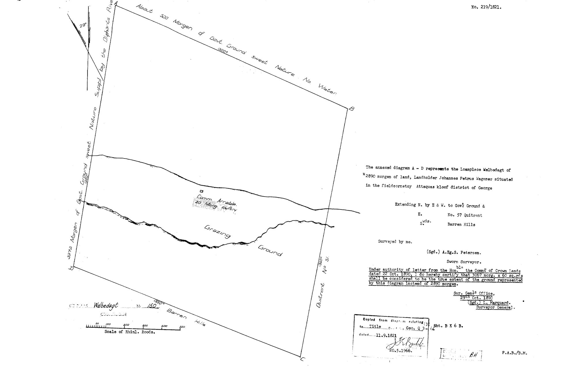
10Q9MG01 welbedacht oudtshoorn.jpg.Die rekord
- Soort
- Landmeter-generaal-kaart
- Kaartnommer
- 219/1821
- Opgemeet
- 1821
- Getitel
- 11 September 1821
- Akte
- Geo.Q3-64
- Landmeter
- A.Eg.S. Petersen
- Argieflêernaam
- 10Q9MG01 welbedacht oudtshoorn.jpg
Sitasie
- Titel
- S.G. Diagram 219/1821: the LOANPLACE WELBEDAGT, fieldcornetcy Attaquas kloof, district of George - now Welbedagt No. 150, Oudtshoorn
- Bewaarplek
- Surveyor-General, Western Cape. Supplied by Frans in the inbox
- Verwysing
- Diagram 219/1821; title deed Geo.Q3-64
- Soort
- SG diagram
- Afgehaal
- 2026-08-18
Die grond waaroor dit gaan
Welbedagt Nr. 150 (Attaquaskloof, Oudtshoorn) 150
Navorsingsnotas
Filed from the inbox 18 Aug 2026. NOT TIED TO A PARCEL: this farm is in the old Swellendam district and not in the Koup, so it gets a bounded set of records and no parcel row, the same treatment as Modderfontein 417 in SRC-466. Read in full on its source row.
Filed from the inbox 18 Aug 2026. Read in full on its source row.
[22 Sep 2026] TIED TO PAR-000277. This row carried 'NOT TIED TO A PARCEL: this farm is in the old Swellendam district and not in the Koup, so it gets a bounded set of records and no parcel row' - true when it was written, and out of date within days: the parcel was created and pinned as PAR-000277, and the sheet is that farm's own diagram. A second, smaller scan of the same sheet arrived on 22 Sep 2026 and went to _inbox/_discard: a sheet is a row.
Die navorsing agter hierdie bladsy, apart gehou daarvan: gedateerde werksnotas, oop vrae, en wat nog nie uitgemaak is nie.
Die werksnotas op hierdie werf word in Engels gehou en word nie vertaal nie. Hulle verander met elke navorsingsessie, en 'n vertaling sou uit pas raak met die oorspronklike. Alles anders - die stories, die getranskribeerde dokumente en die koppelvlak - is in Afrikaans.