Landmeter-generaal-kaart, 947/1909, April 1909
Landmeter-generaal-kaart, April 1909
10TRNV01 (1).TIF.Die rekord
- Soort
- Landmeter-generaal-kaart
- Kaartnommer
- 947/1909
- Opgemeet
- April 1909
- Getitel
- 7 Augustus 1909
- Akte
- 5220
- Landmeter
- W. Versfeld
- Eksaminator
- W.P. Murray
- Argieflêernaam
- 10TRNV01 (1).TIF
Sitasie
- Titel
- Spreeufontein Portion 5 (Lot C) diagram, 1909
- Bewaarplek
- Surveyor-General
- Verwysing
- SG Dgm 947/1909
- Soort
- SG diagram
Die grond waaroor dit gaan
Lot C (Spreeufontein Nr. 26 Gdlt 5)
Navorsingsnotas
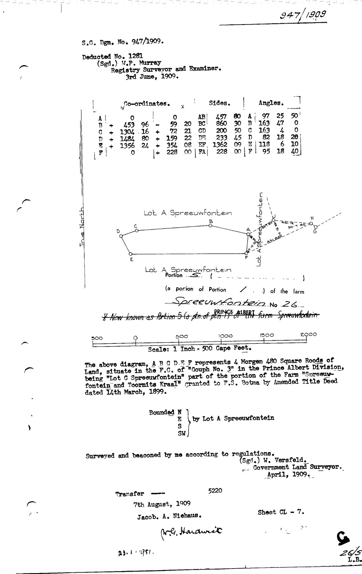
"Lot A Spreeuwfontein, Portion 5 (a portion of Portion 1) of the farm Spreeuwfontein No.26, Prince Albert." Body text names it "Lot C Spreeuwfontein" - the title block's "Lot A" heading is the surrounding parent (bounded N, E, S, SW by Lot A Spreeuwfontein), not this parcel's own name; a struck-through annotation confirms "Now known as Portion 5 (a ptn. of ptn 1) of the farm Spreeuwfontein." 4 morgen 480 square roods, "being 'Lot C Spreeuwfontein' part of the portion of the Farm 'Spreeuwfontein and Toornits Kraal' granted to F.S. Botma (PER-000323) by Amended Title Deed dated 14th March, 1899." Surveyed and beaconed April 1909 by W. Versfeld, Government Land Surveyor. Deducted No. 1281, examined by W.P. Murray, Registry Surveyor and Examiner, 3 June 1909. "Transfer 5220, 7th August 1909, Jacob. A. Niehaus" (PER-000322). Matches DOC-0015's own deduction table for Spreeufontein exactly ("Lot C = Ptn 5, 4mg 480sr, deed 1909-83-5220") - no discrepancy. CLOSES THE LAST UNDOCUMENTED PORTION OF SPREEUFONTEIN'S OWN SUBDIVISION SET (PAR-000024 previously had no diagram at all).
Die navorsing agter hierdie bladsy, apart gehou daarvan: gedateerde werksnotas, oop vrae, en wat nog nie uitgemaak is nie.
Die werksnotas op hierdie werf word in Engels gehou en word nie vertaal nie. Hulle verander met elke navorsingsessie, en 'n vertaling sou uit pas raak met die oorspronklike. Alles anders - die stories, die getranskribeerde dokumente en die koppelvlak - is in Afrikaans.