Landmeter-generaal-kaart, 641/1838, 1838
Landmeter-generaal-kaart, 1838
10686447.jpg.Die rekord
- Soort
- Landmeter-generaal-kaart
- Kaartnommer
- 641/1838
- Opgemeet
- 1838
- Getitel
- 1 November 1838
- Landmeter
- F. Rawstone
- Argieflêernaam
- 10686447.jpg
Sitasie
- Titel
- Ockerts Kraal No. 502 diagram 641/1838
- Bewaarplek
- Surveyor-General
- Verwysing
- SG Dgm 641/1838, title Sw.Q.13-79
- Soort
- SG diagram
- Afgehaal
- 2026-08-23
Die grond waaroor dit gaan
Ockerts Kraal Nr. 200 (Ladismith) 200
Navorsingsnotas
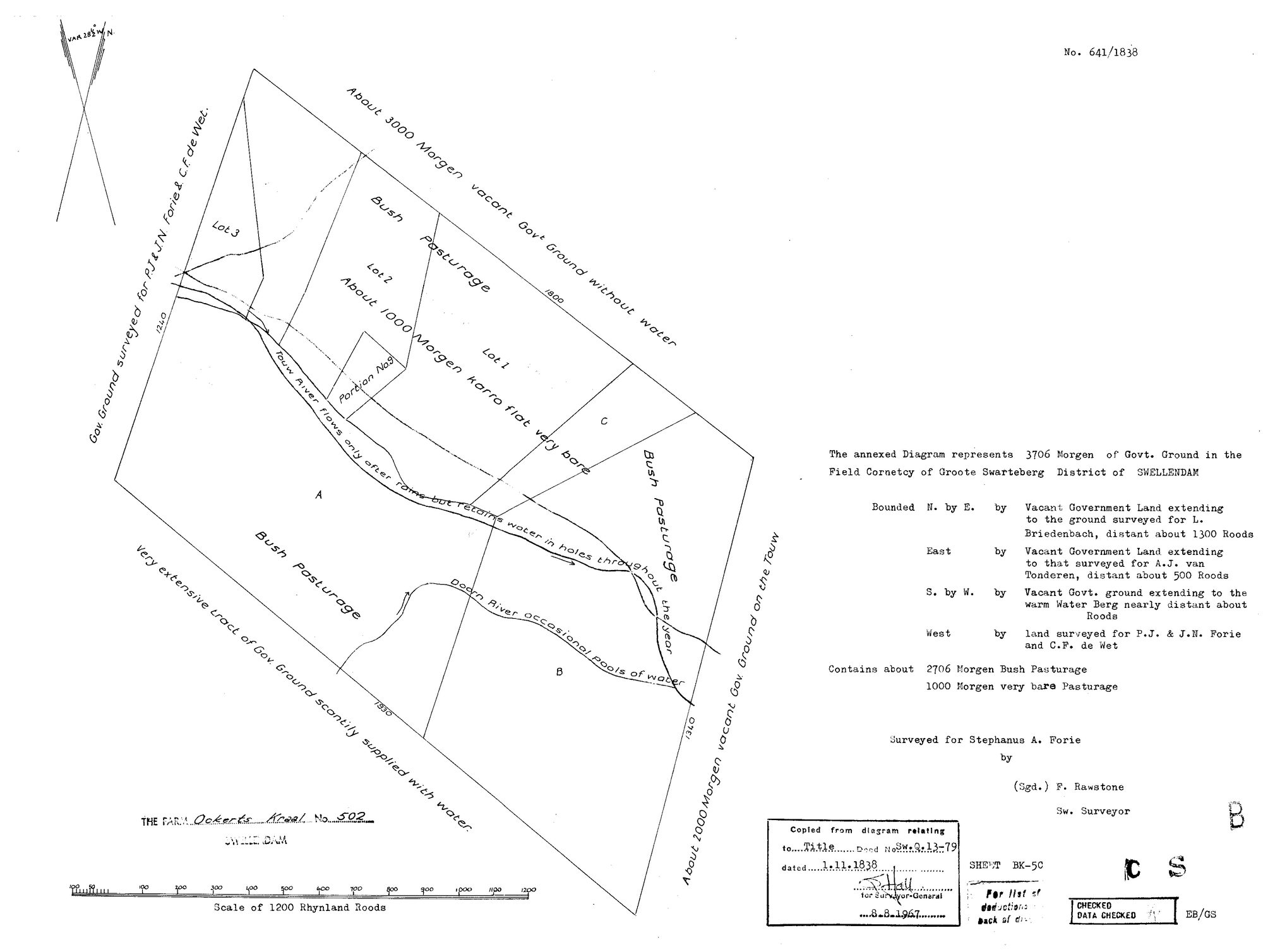
'The annexed Diagram represents 3706 Morgen of Govt. Ground in the Field Cornetcy of Groote Swarteberg, District of SWELLENDAM.' Surveyed for STEPHANUS A. FORIE by F. Rawstone, Sworn Surveyor; title Sw.Q.13-79 dated 1.11.1838. Bounded N by E by vacant Government land extending to ground surveyed for L. Briedenbach, about 1300 roods; EAST by vacant Government land extending to that surveyed for A.J. VAN TONDEREN, about 500 roods; S by W by vacant Government ground extending to the WARM WATER BERG; WEST by land surveyed for P.J. and J.N. Forie and C.F. de Wet. Contains about 2706 morgen bush pasturage and 1000 morgen very bare pasturage. On the TOUW RIVER (flows only after rains but retains water in holes throughout the year) and the DOORN RIVER (occasional pools). Lots 1, 2 and 3 and Portion No. 1 are drawn.
Die navorsing agter hierdie bladsy, apart gehou daarvan: gedateerde werksnotas, oop vrae, en wat nog nie uitgemaak is nie.
Die werksnotas op hierdie werf word in Engels gehou en word nie vertaal nie. Hulle verander met elke navorsingsessie, en 'n vertaling sou uit pas raak met die oorspronklike. Alles anders - die stories, die getranskribeerde dokumente en die koppelvlak - is in Afrikaans.