Kaart se keersy, 861/1873 (verso), 1873
Kaart se keersy, 1873
10TRF301.jpg.Die rekord
- Soort
- Kaart se keersy
- Kaartnommer
- 861/1873 (verso)
- Opgemeet
- 1873
- Getitel
- 1950
- Argieflêernaam
- 10TRF301.jpg
Sitasie
- Titel
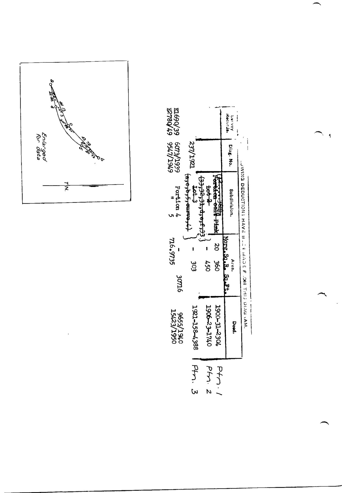
- Verso deduction table, SG diagram 861/1873, Rhemhoogte No. 8 (Gouph)
- Bewaarplek
- Surveyor-General, Cape Town (SGCTN)
- Verwysing
- dgm 861/1873 verso
- Soort
- SG diagram
- Afgehaal
- 2026-07-31
Die grond waaroor dit gaan
Navorsingsnotas
[31 Jul 2026 inbox] The verso of DOC-0083, which was filed from the recto only. Five portions, 1900 to 1950. NOTE THE FARM: this is Rhemhoogte No. 8 in the GOUPH ward on the Gamka, NOT Reim Hoogte No. 167 in the Zwartberg ward next to Middelwater (PAR-000092), which arrived in the same day's inbox. Two different farms, similar names, both Prince Albert division - the same trap as the two Middelwaters and the two Klipfonteins.
[5 Aug 2026, verso-date sweep] §8: this verso carries endorsements LATER than its front, so it takes its own content dates instead of inheriting. The newest line is deed 15423/1950 (SRC-164). Inherited 1881 from front 861/1873 and published; now reads 1950 and is withheld.
[5 Aug 2026] doc_type corrected from SG_diagram to SG_diagram_verso. This row's sg_diagram_no already carried the '(verso)' suffix, so the scan gate read it correctly, but render.DOC_TYPE_LABEL maps the two types to different public labels - the site called this back of a sheet a 'Surveyor-General diagram' - and every per-type count double-counted a front. The 31 Jul verso batch predates the convention 8 records.
[5 Aug 2026] publish_ok=yes. THE SHEET WAS OPENED AND READ, AND IT NAMES NOBODY. Five lines, portions 1 to 5, 1900 to 1950, and a small figure enlarged for data. That is the whole of it: portion numbers, portion NAMES, extents in morgen and square roods, diagram numbers, survey-record numbers, deed numbers and dates. Not one person appears on it. The 1936 scan cut-off exists because a JPEG is opaque to every text check in leak_tests.py, so a document's DATE is the only proxy available for whether the sheet names a living person. On a deduction table that proxy measures the wrong thing: the table is a record of GROUND, and withholding it withholds the farm's own history to protect nobody. Same decision, same reason and same mechanism as DOC-0081 on 3 Aug, when [FAMILY] I was talking about the old farm diagrams only. The date fields stay as they are, because the row has to state what is on the paper and the earlier inheritance from the front was simply wrong. What changes is that the release is now a decision somebody took after looking at the sheet, which is the only thing publish_ok has ever been for.
[5 Aug 2026] survey_edtf CORRECTED to '1873', from ''. It had the year of the SURVEY RECORD CITED IN THE DEDUCTION LINE, which is a date the table refers to, not a date this sheet was made. A verso is physically the same piece of paper as its front and was surveyed when the front was (DOC-0083, 861/1873); the later endorsement belongs in title_edtf, which carries it. _doc_year() takes the max either way, so the gate reads the same year as before and nothing about what publishes changed. The publish_ok escape is bounded independently in leak_tests to SG diagrams whose own survey predates 1942, so this row's survey_edtf has to be the FRONT's survey year for the sheet to be released at all.
Die navorsing agter hierdie bladsy, apart gehou daarvan: gedateerde werksnotas, oop vrae, en wat nog nie uitgemaak is nie.
Die werksnotas op hierdie werf word in Engels gehou en word nie vertaal nie. Hulle verander met elke navorsingsessie, en 'n vertaling sou uit pas raak met die oorspronklike. Alles anders - die stories, die getranskribeerde dokumente en die koppelvlak - is in Afrikaans.